
 12 hours ago
3
12 hours ago
3
PROTECT YOUR DNA WITH QUANTUM TECHNOLOGY
Orgo-Life the new way to the future Advertising by Adpathway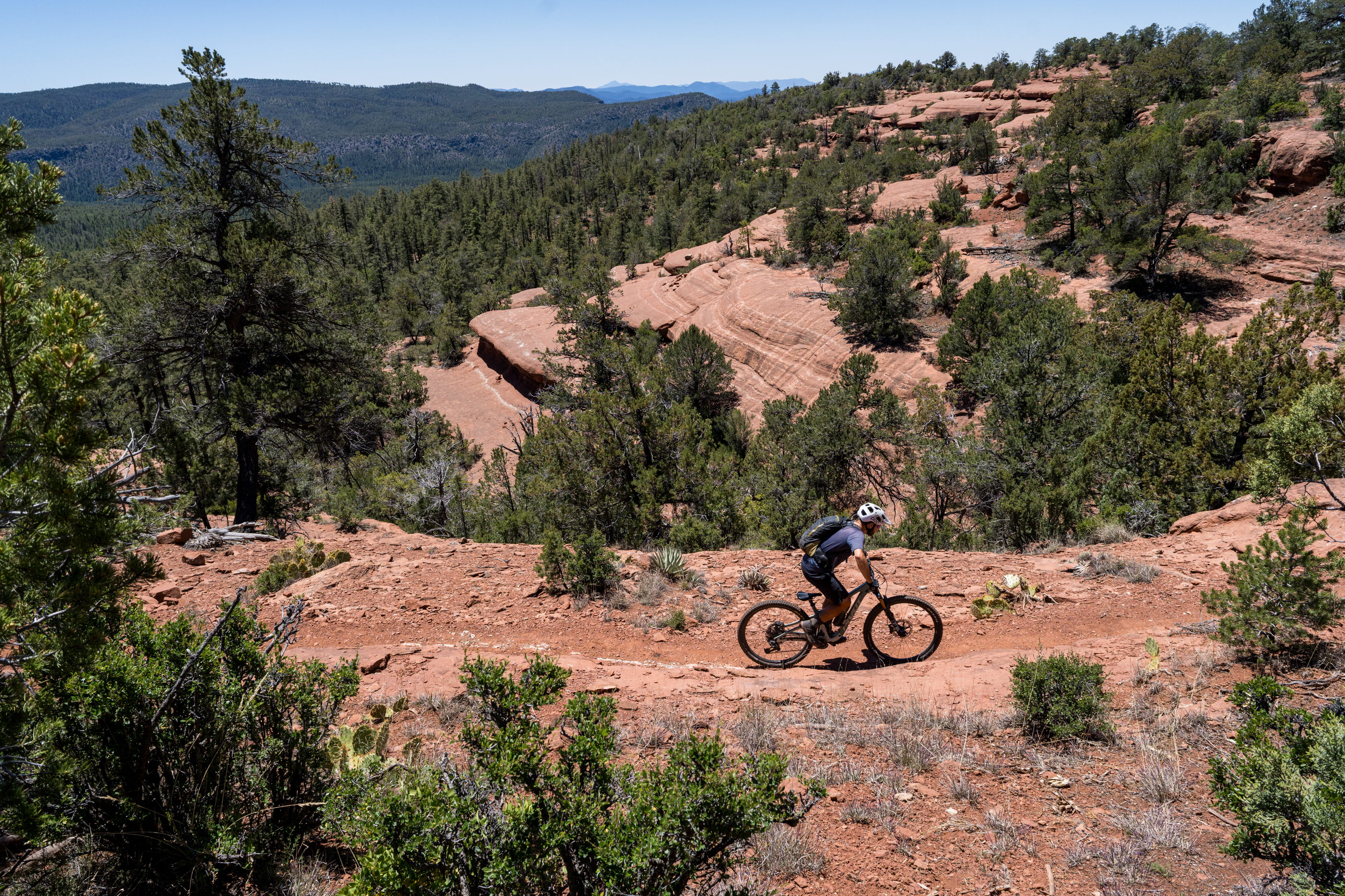 All photos by Leslie Kehmeier
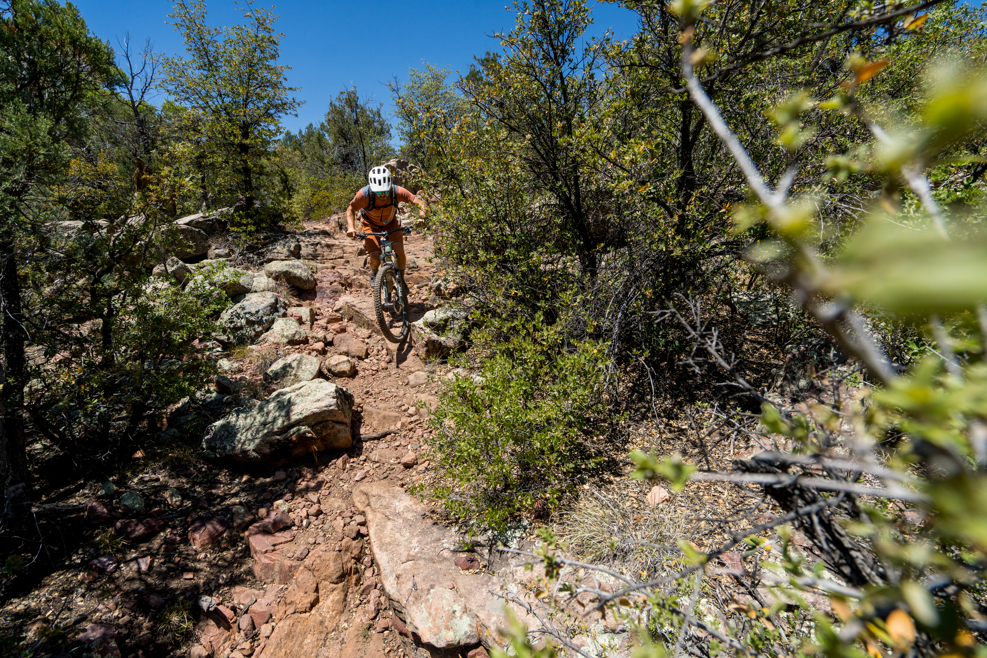
The holy grail of backcountry mountain biking is the point-to-point singletrack trail.
Not a loop. Not a convoluted network. Not a dirt road. Uninterrupted singletrack that takes you from A to B via an epic landscape that will leave an impression lasting a lifetime.
Unfortunately, many of the iconic — and most-ridden — point-to-point mountain bike routes are anything but high-quality singletrack. The Kokopelli trail immediately springs to mind: this highly-trafficked route might be popular, but the on-the-ground reality is that much of the so-called “trail” consists of boulder-filled 4×4 roads followed by soul-sucking sand pits. And where the trail does narrow to singletrack, it’s rough, steep, and not very much fun. Still other iconic desert routes, like the White Rim, are 100% jeep road.
But there’s a new route on the map that you may not have heard of, and it’s set to change the paradigm for backcountry singletrack riding. It’s known as the Highline Trail. At 63 miles long, this otherworldly point-to-point trail traverses a landscape so diverse and so lush that it’s genuinely unique amongst mountain bike trails — and it might just be the finest backcountry singletrack you’ll ever ride.
A wilderness adventure on the Highline Trail
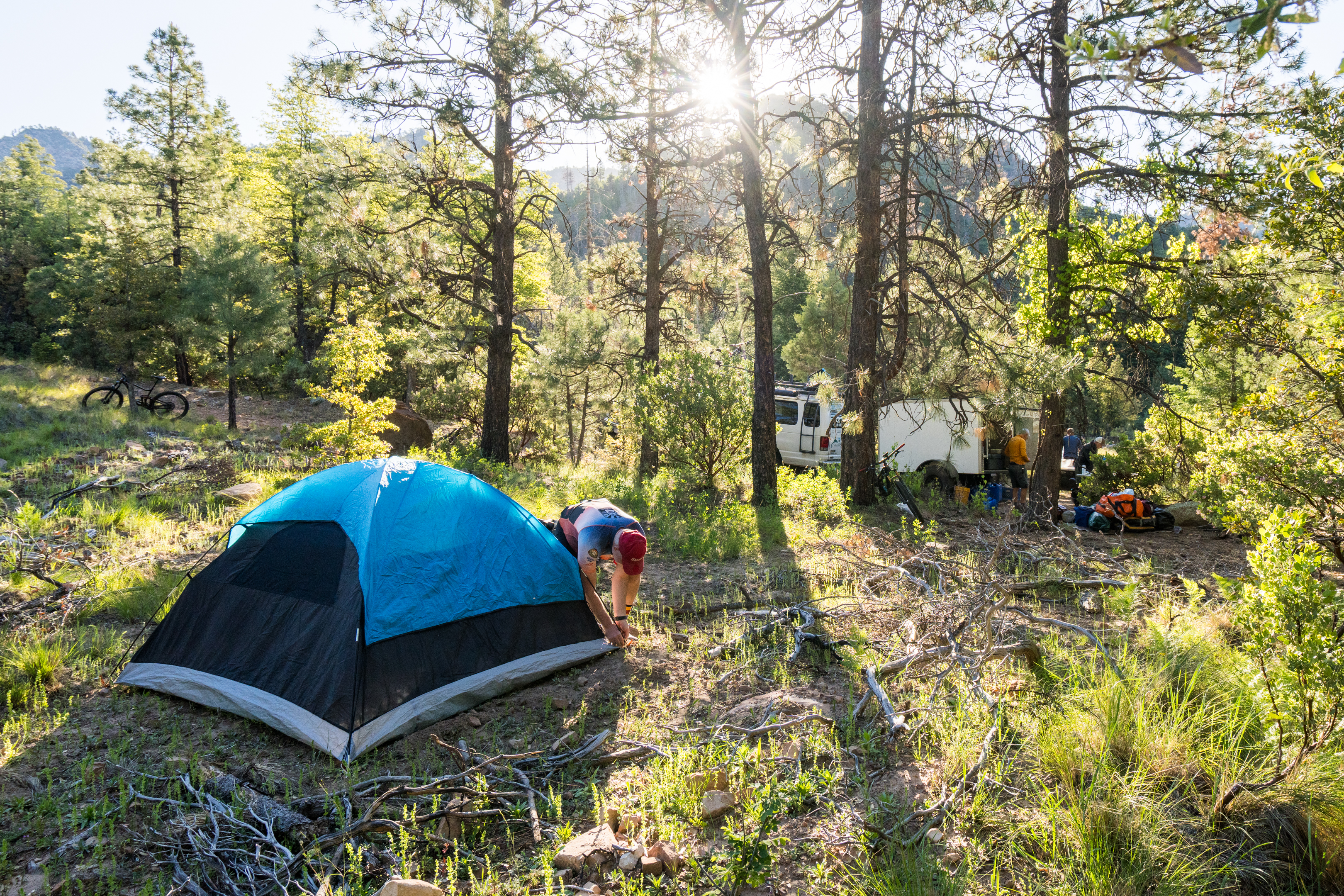
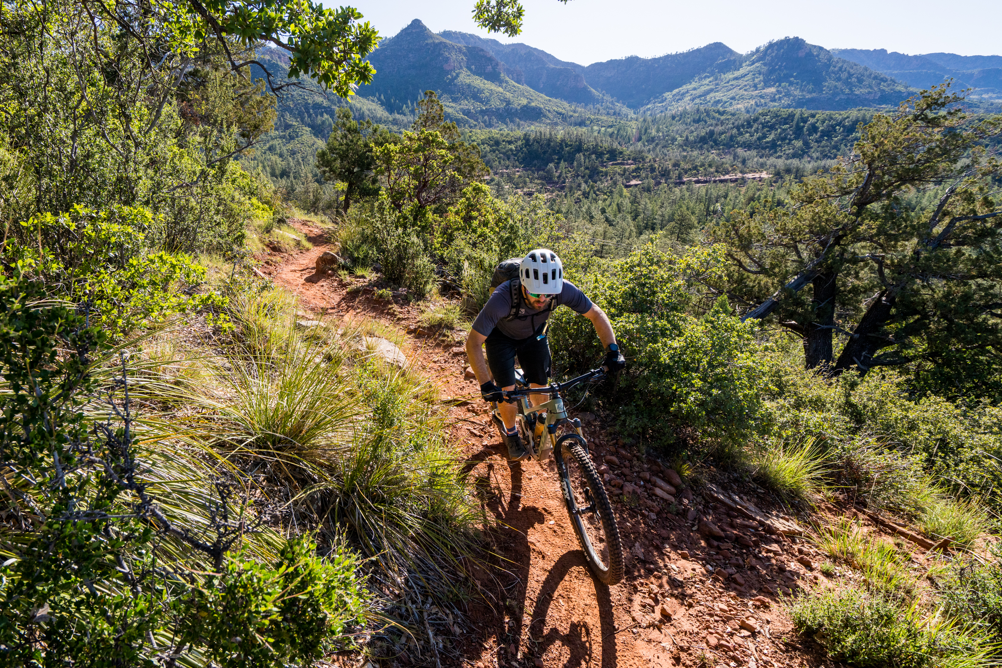
I recently joined a Hermosa Tours trip on the Highline to experience the trail for myself. Over the course of three days of riding, the stunning beauty and remote wilderness of the Highline Trail unfurled in front of us. As we’d slowly discover, the Highline traverses a rugged, remote wilderness that hides an astonishingly diverse landscape. The jagged rim above us was our constant companion, with vaulted rock outcroppings, soaring towers of stone, and forested ridges in between. But because we were riding below the rim, the landscape is shockingly lush for Arizona.
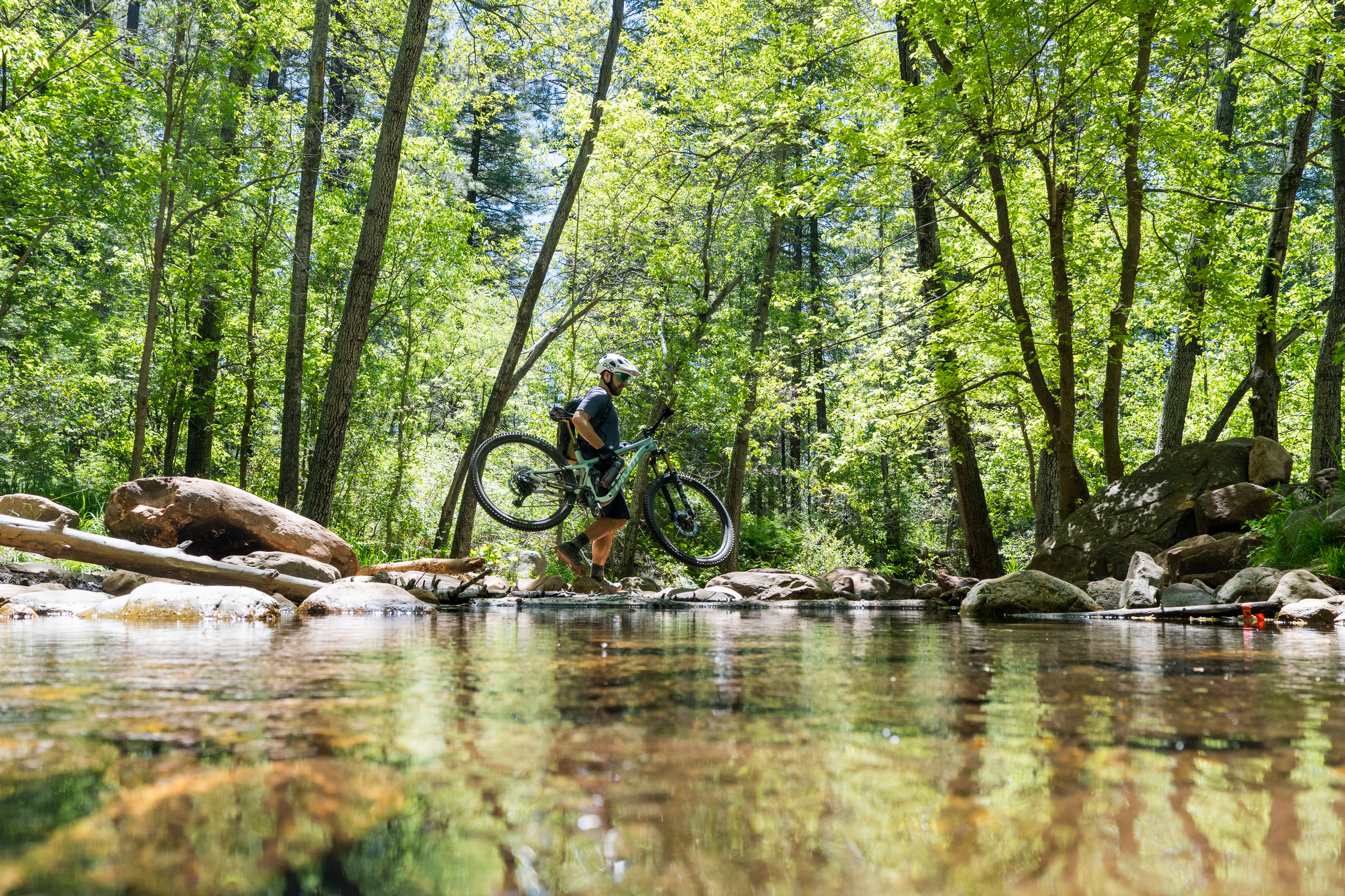
Numerous springs burst forth from the broken rocks on the side of the mountain, feeding a bevy of year-round streams, which are almost unheard of in Arizona. At one point, we had the chance to hike up a stream to see the spring that fed it. When I think of a “spring,” I tend to envision water seeping slowly out of the ground. Instead, we saw streams of water pouring forth from a rocky cliff, gushing down through the boulders, and forming a rushing waterway within just a few feet. These “springs” are more akin to waterfalls shooting out from the fractured foot of the Colorado Plateau, nourishing abundant plant and animal life along a short span before the landscape transitions into arid desert and the elevation drops rapidly.
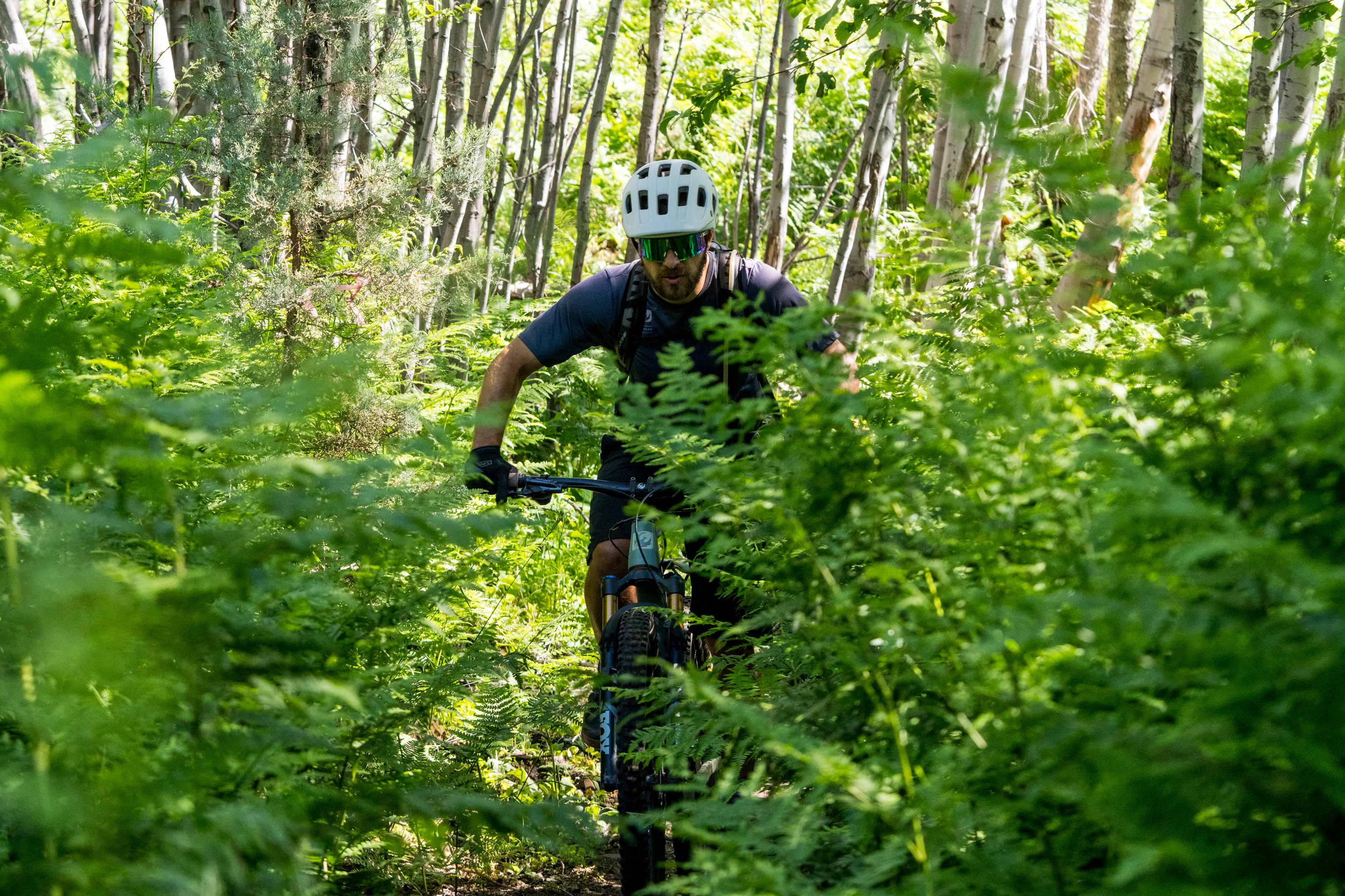
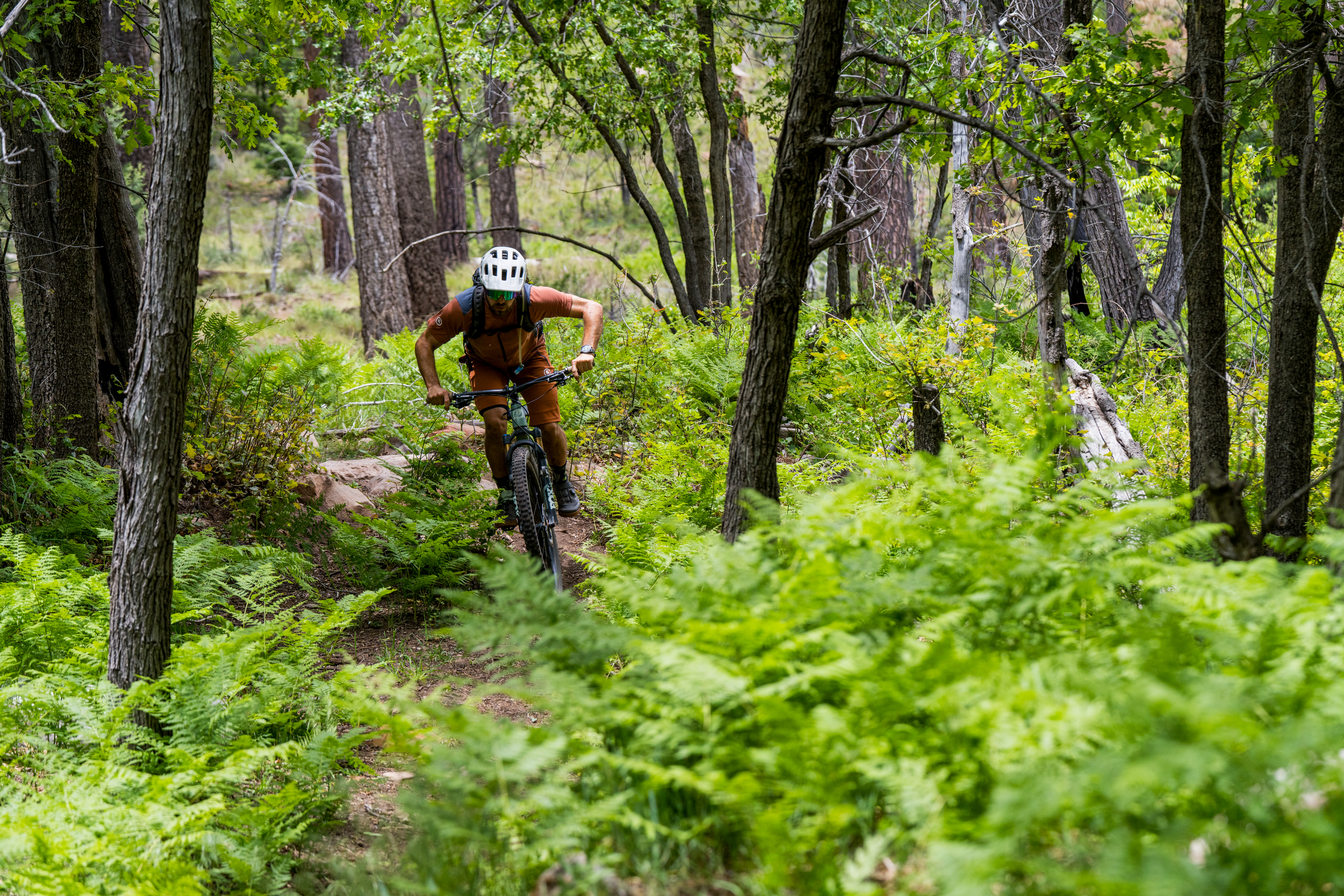
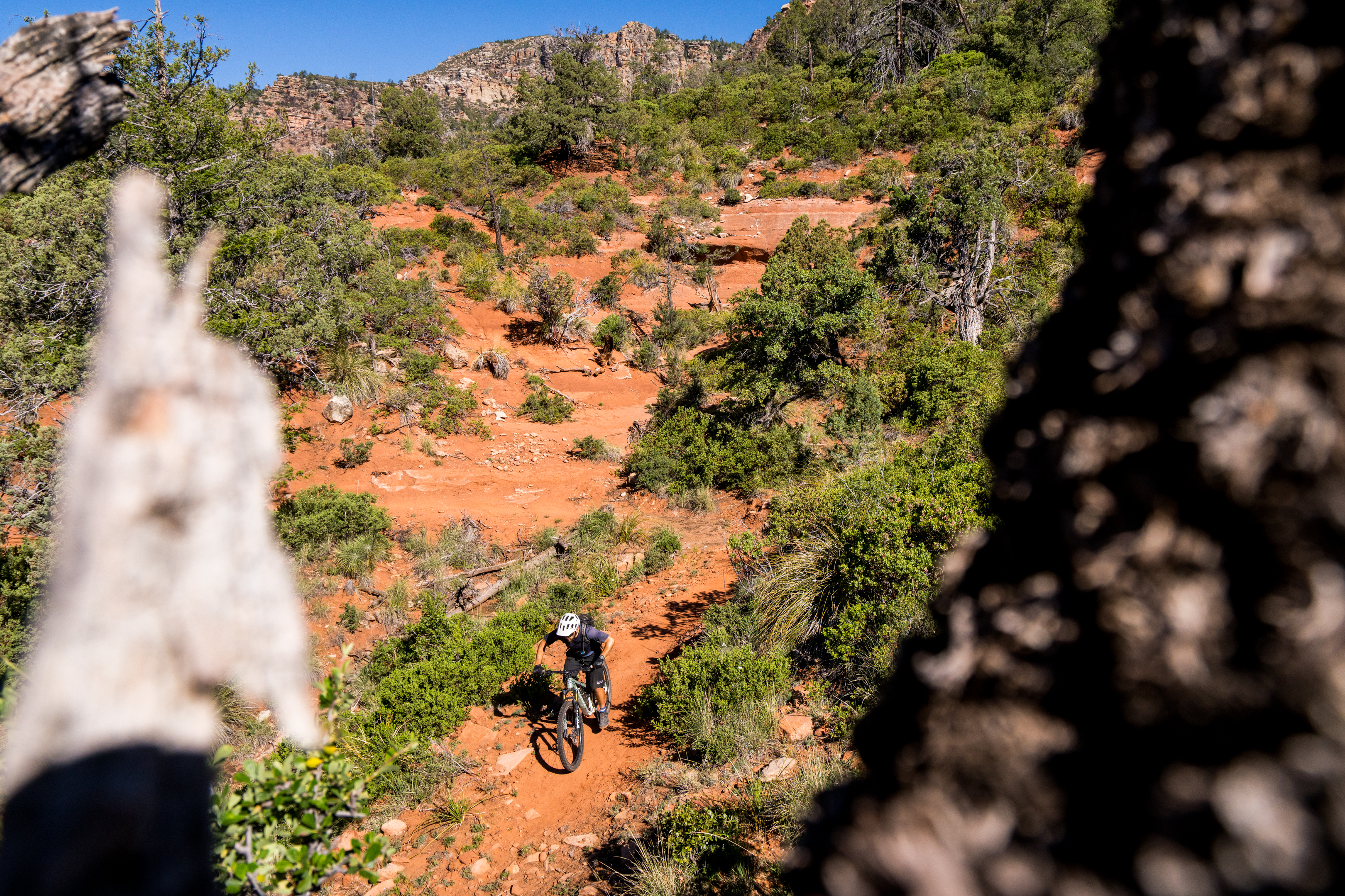
The trail climbs up and down, traversing this narrow corridor of verdant plant life. The forest is densest near the spring-fed streams, with a lush understory filled with ferns and towering deciduous trees. Where the trail climbs to cross a ridge, the terrain quickly turns arid, with the deciduous trees replaced by ponderosa pines and gnarled alligator junipers — a subspecies so named thanks to its unique bark that looks like the scales of an alligator. These unique juniper trees would be our constant companion for the entire trip, and we spent our first night camped beneath the crooked arms of one of the largest specimens in the region.
In the final two segments of the trail, as the elevation drops, exposed stretches are choked with manzanita, red-skinned, bushlike trees that provide a visual contrast to the gray trunks of the junipers.
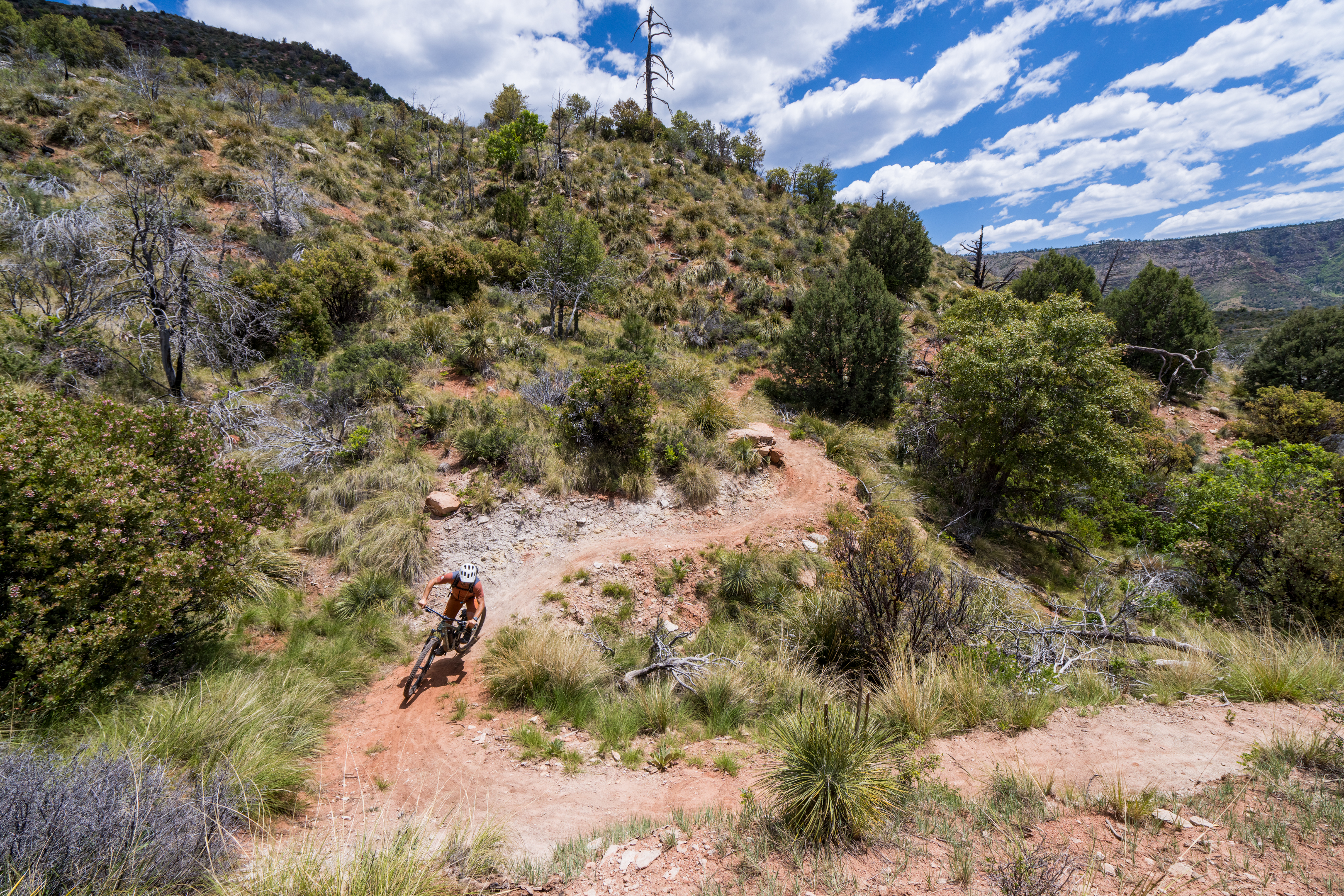
As you might imagine, the soil and trail character shifts dramatically with the landscape, but the bulk of the trail tread is sandy with sandstone rocks. In the lush zones, the dirt gets darker, but unexpectedly, the tread will transition sharply to red rock slabs.
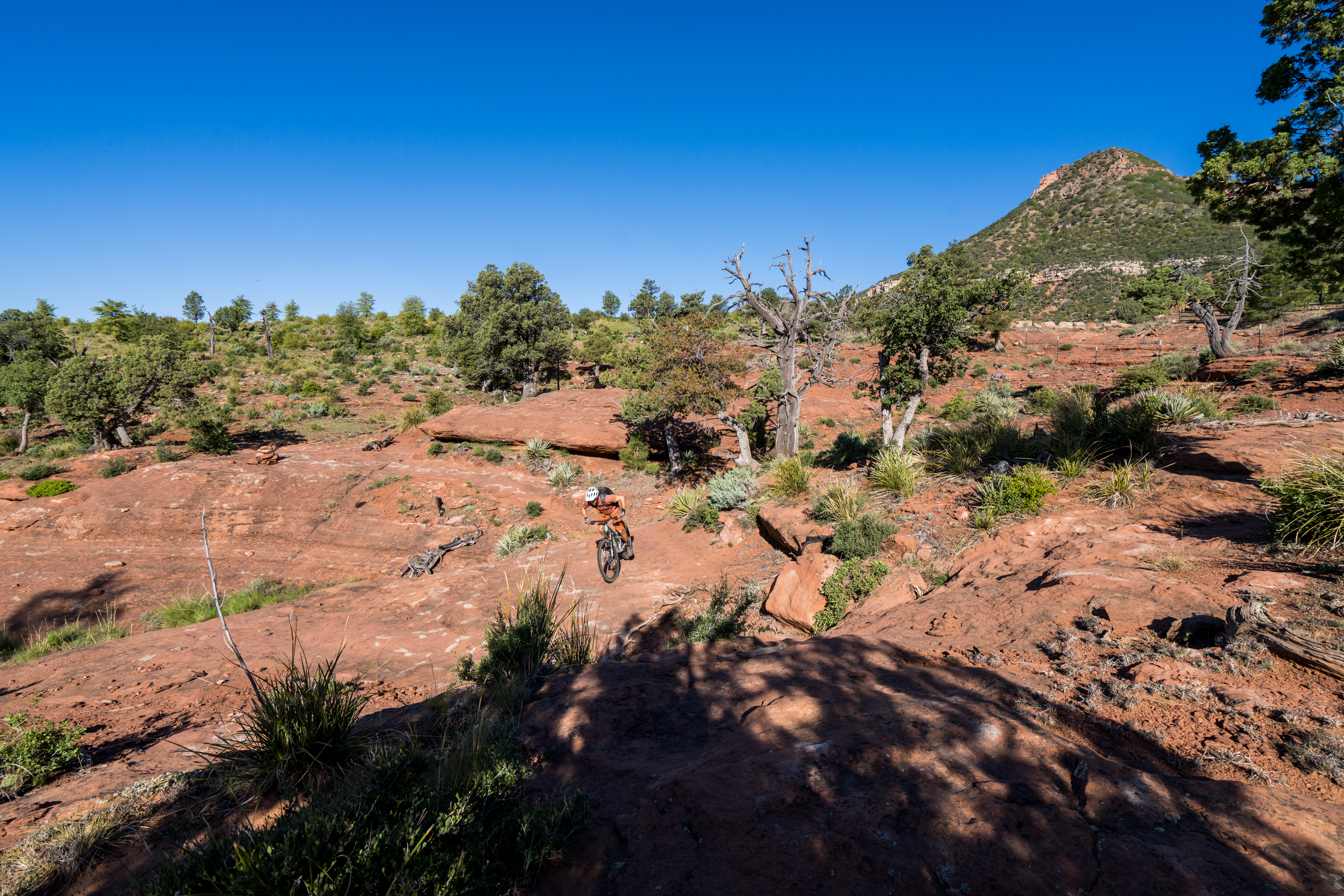
Yes, red rocks — just like the ones you’ll find in Sedona.
Hermosa Tours owner Matt McFee characterizes the Highline as riding in “Flagstaff and Sedona at the same time,” to give riders a sense of just how diverse the landscape is. But even that description falls short of the stunning diversity and lush vegetation you’ll find on this incredible trail.
As we rode through this otherworldly landscape, we couldn’t find much of anything to compare it to. Highline might be unique amongst mountain bike trails.
Over 150 years of history on the Highline Trail
The Mogollon Rim runs just north of Payson, Arizona, cutting 200 miles eastward from Sedona to the New Mexico border. Rising to about 8,000 feet above sea level, this dramatic escarpment forms the southern edge of the elevated Colorado Plateau. One thousand feet below the jagged rim, you’ll find the Highline Trail.
Established in 1870, Highline was originally used to travel between homesteads, hunt, and move livestock, and was designated a National Recreation Trail in 1978. Originally about 50 miles of non-motorized singletrack, it became obvious that the historic trail had been built in an unsustainable fashion. “Because of the escarpment of the Mogollon Rim and all of the drainages that come off it, the trail goes up and down and up and down, across dozens and dozens of drainages,” Shannon Smith, Stewardship Coordinator for the Tonto National Forest, told Singletracks. “When it was originally built, it was built more or less as a straight line across all of those [drainages].” Significant erosion followed, and substantial portions fell into disrepair — to the point that, as Smith put it, “There are sections where [the trail] all but disappeared. It either got overgrown, or it got so washed out that it just kind of ended up being a slope of boulders instead of a trail.”
Official plans to restore and reroute sections of the trail were announced in 2021, championed by Angie Abel, the Head of Recreation for the Payson Ranger District in the Tonto National Forest. The restoration plan was built around a threefold approach: maintain as much of the original historic route as possible, reroute the badly eroded sections, and rehabilitate the washed-out areas so the old alignments didn’t continue to deteriorate.
Since then, the Forest Service, in conjunction with non-profit partners such as the Rim Country Mountain Biking Association (RCMBA) and the National Forest Foundation (NFF), raised about $1 million in funding to complete extensive reroutes on the Highline Trail. They hired several teams of contractors to do the work, including Flagline Trails, Cuddy Mountain Trail Company, and Proline Trails.
These efforts turned a roughly 50-mile trail into 63 miles of fantastic backcountry singletrack that’s now eminently rideable and thoroughly enjoyable.
A four-day tour of some of the best backcountry singletrack you’ll ever ride
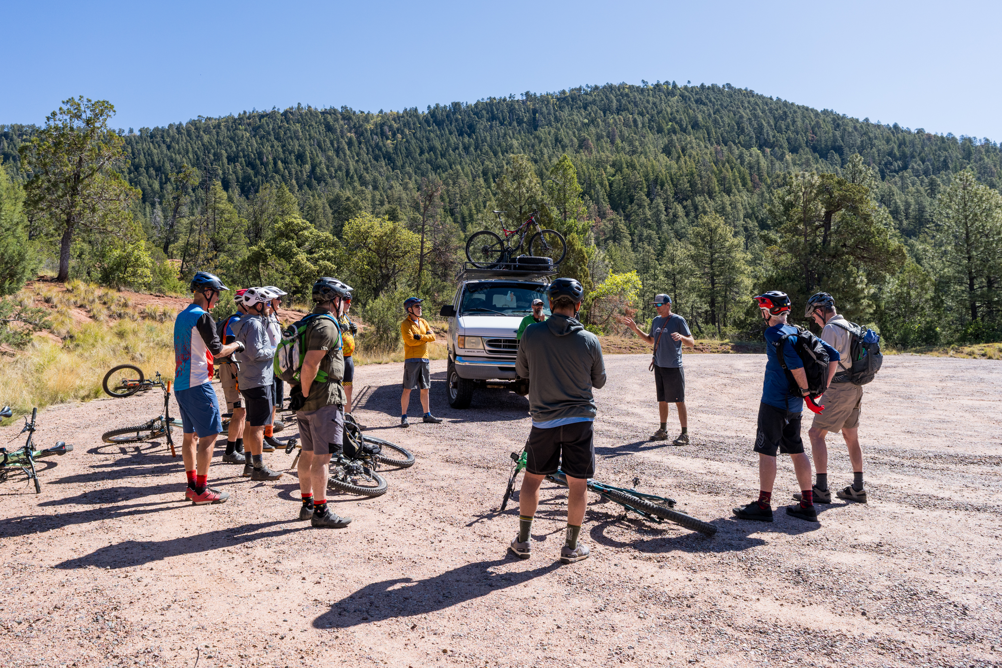
Sixty three miles of remote backcountry singletrack might sound like a day ride for some, or an overnight bikepack for others, but most mountain bikers will need logistical support to complete the Highline Trail.
That’s where Hermosa Tours comes in.
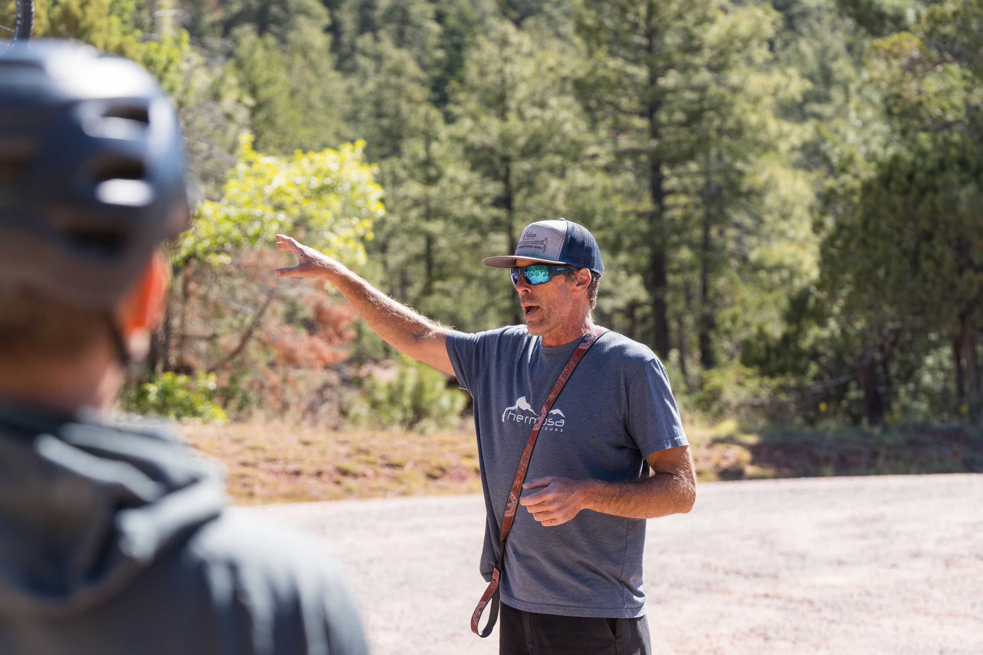
Matt McFee started Hermosa Tours 19 years ago, and since then, he’s been heavily involved in the mountain bike scene in Colorado, Utah, and Arizona. McFee has assisted with the Highline Trail project from the start, supporting fundraisers with free trip giveaways and lending his expert advice on what makes an iconic backcountry experience. He was already heavily involved in running guided tours on the Arizona Trail, as one of the first tour operators to receive a permit to guide on the AZT, which runs concurrently with the Highline Trail for about 21 miles.
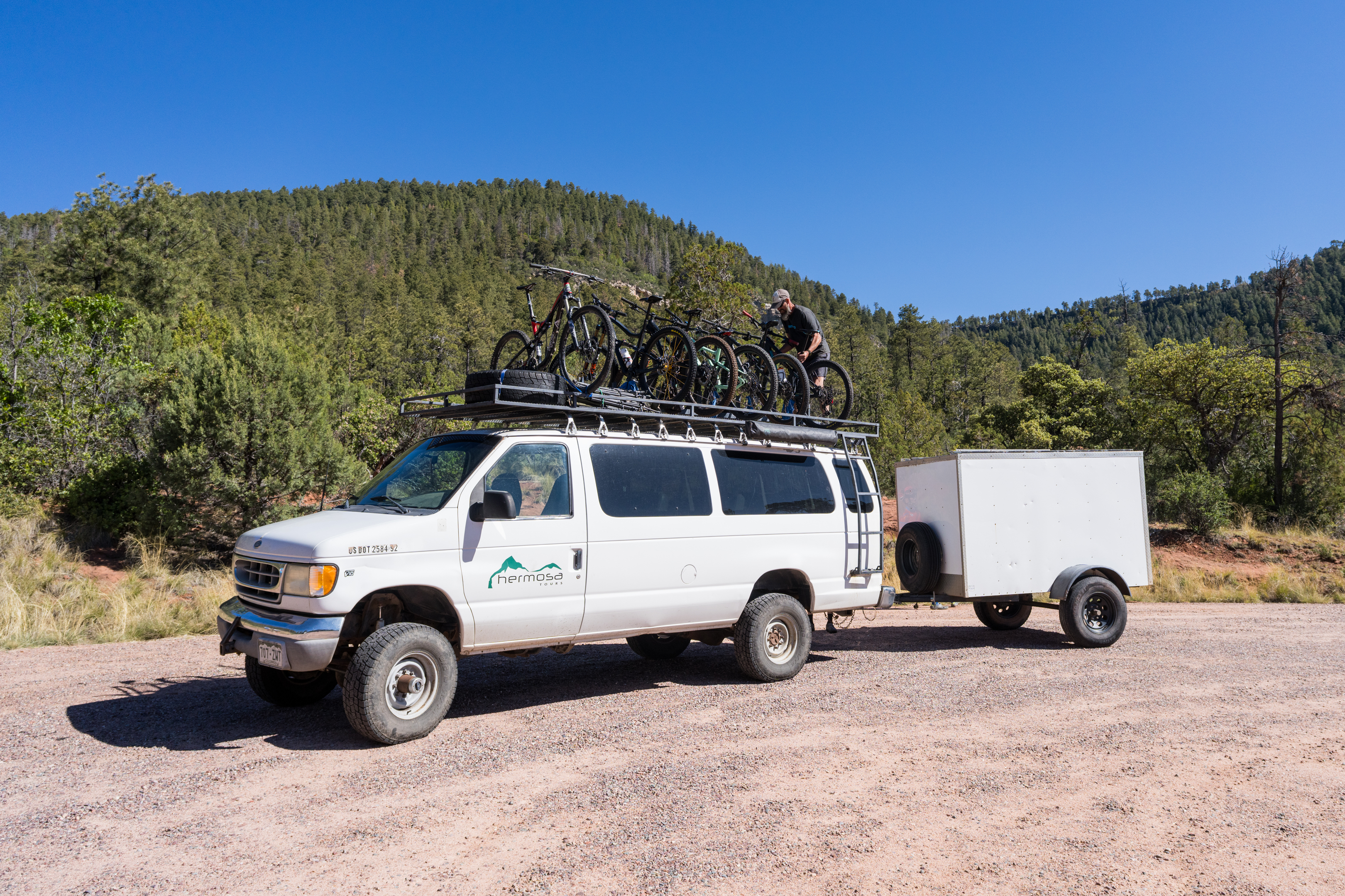
Hermosa Tours offers a unique self-guided tour model. Instead of an expensive, fully-catered experience with guides hand-holding the clients along the trails, riders with Hermosa Tours must navigate and otherwise fend for themselves while out on the trail. But once the ride is complete, they’ll roll into camp with a kitchen fully set up and ready to go, and all their bags waiting for them. Before the trips, clients have to shop for themselves, and they have to do their own cooking using the provided kitchen.
McFee said that his unique model was inspired by his own friend group back in the day, saying that most of his adventurous friends don’t need — or even want — hand-holding. But a little logistical help is nice.
“It’s also a lot easier to get 10 of your friends to do this, versus the one guy who makes good money because he’s a lawyer. He can do the fully guided, catered Tour de France tour, but he can’t get any of his friends to,” said McFee. “Everybody can probably scratch together four or 500 bucks for a four- or five-day tour.”
The Hermosa Tours experience on the Highline Trail adds in a 23-mile loop around Pine for day four, creating an 89-mile tour averaging just over 20 miles per day for $475 per person.
Here’s how each segment breaks down.
 Inner Sanctum
A segmented approach makes Highline incredibly rideable
The Highline Trail is divided into three roughly equal-length segments: Gathering Waters, Inner Sanctum, and Geronimo’s Call. When ridden east to west, riders will enjoy a net elevation loss of about 1,300ft. The trail difficulty is fairly consistent throughout, earning an Arizona intermediate/blue rating. However, the trail character changes with each segment.
Hermosa Tours Highline Trail Tour: Key stats
- Day 1: Highline, Gathering Waters
- 21.6mi
- 1,969ft of climbing
- 2,359ft of descending
- Day 2: Highline, Inner Sanctum
- 22.1mi
- 1,871ft of climbing
- 2,025ft of descending
- Day 3: Highline, Geronimo’s Call
- 22.9mi
- 2,092ft of climbing
- 2,831ft of descending
- Day 4: Pine-Strawberry Loop
- 22.8mi
- 2,619ft of climbing
- 2,584ft of descending
Gathering Waters
Highline Day 1: Gathering Waters
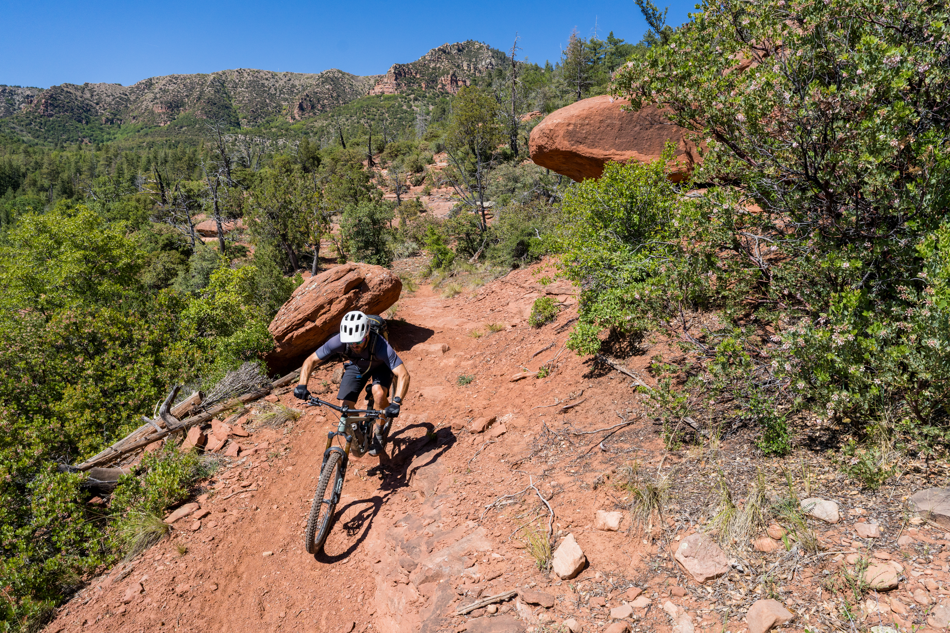
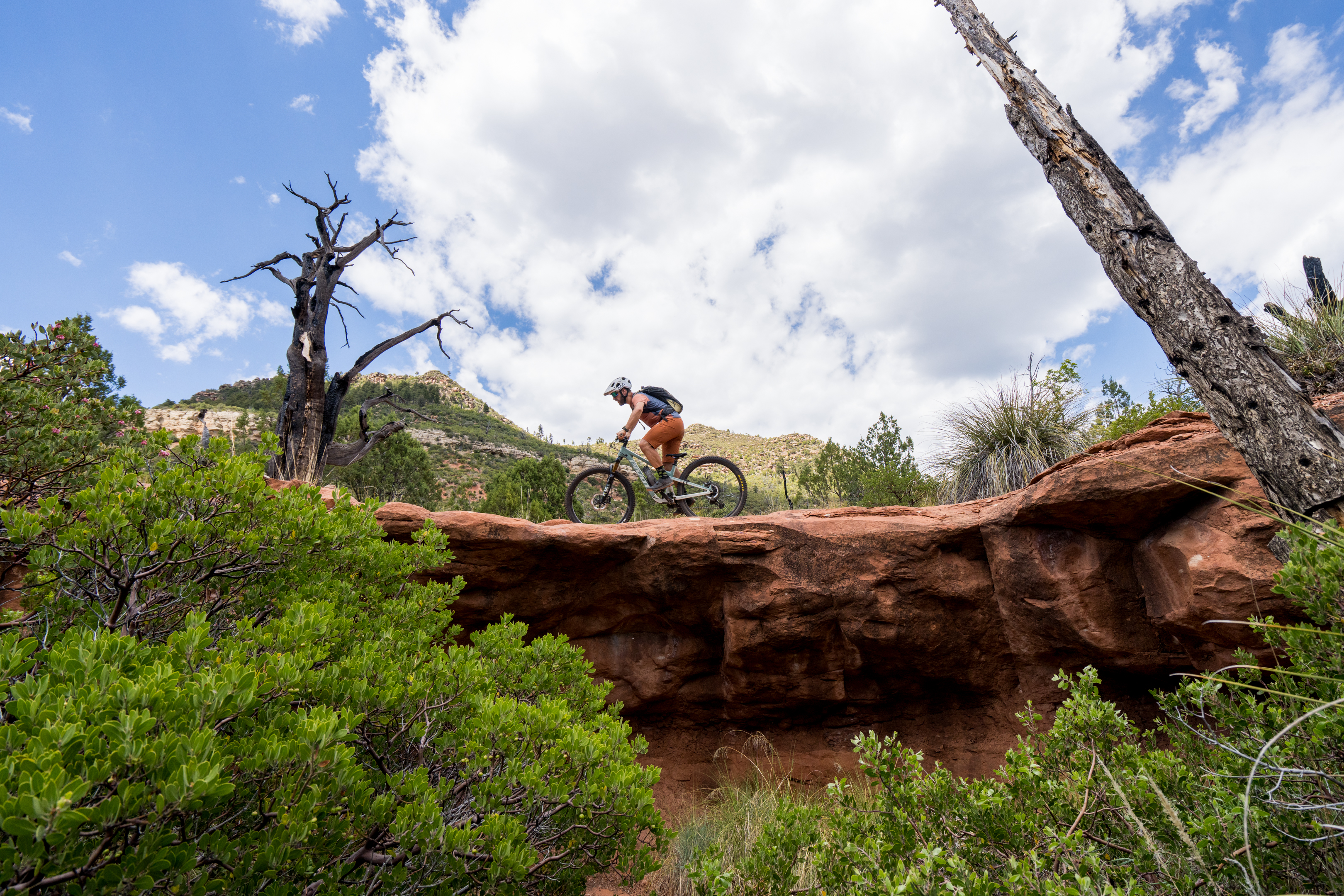
Gathering Waters clearly shows the difference between the recently rerouted segments and the historic sections of trail. On day one, we began by flowing along a machine-built trail for miles, only to be faced with an abrupt climb filled with rocky chunk that would force some riders to dismount. A few of these punchy climbs were followed by steep fall-line descents that were obviously from the original trail. If these segments are the ones that were deemed rideable enough to remain relatively untouched, I shudder to consider how gnarly the rerouted sections must have been. Gathering Waters finished with spectacular red rock slab riding right before camp. While all three days traverse red rocks, days one and two boast the best red rock riding.
 Inner Sanctum
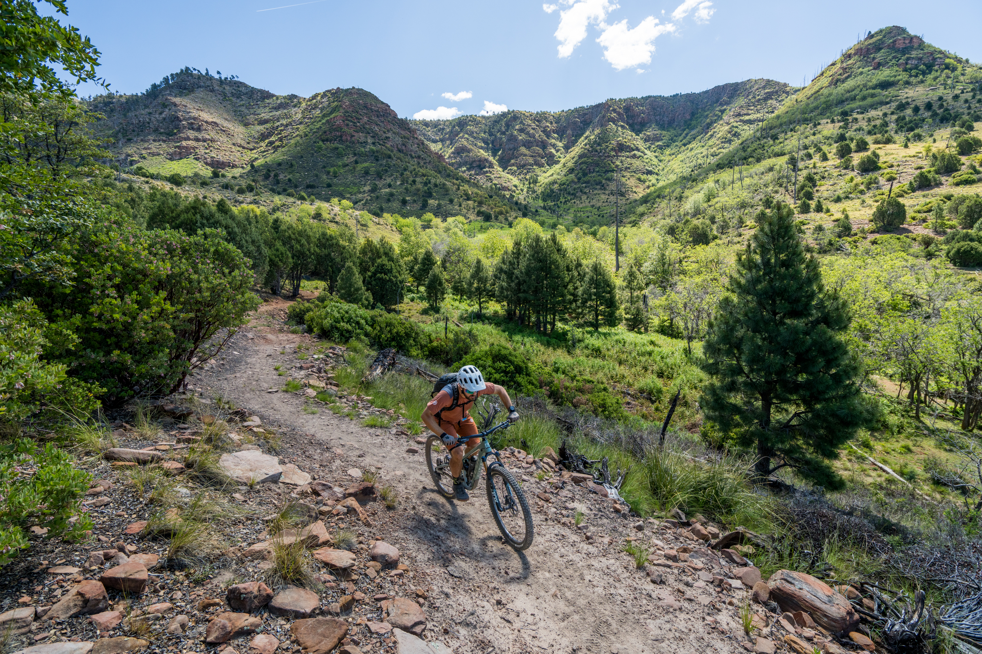
Highline Day 2: Inner Sanctum
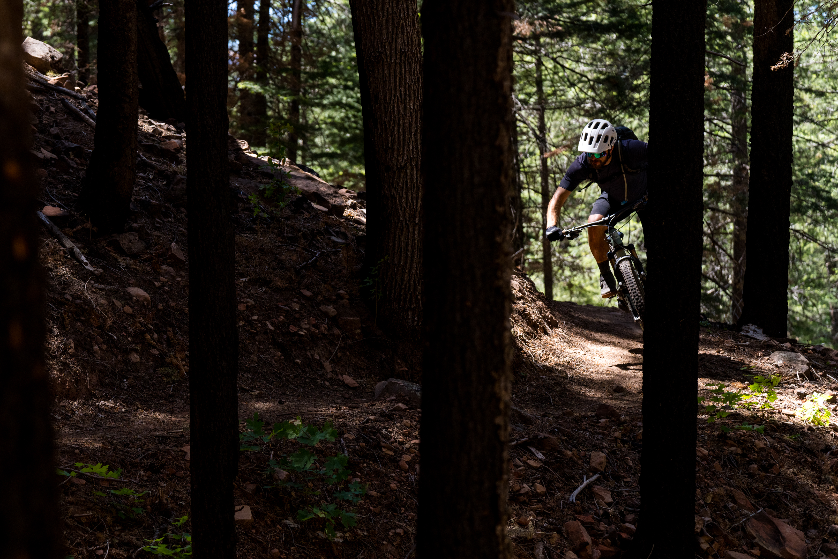
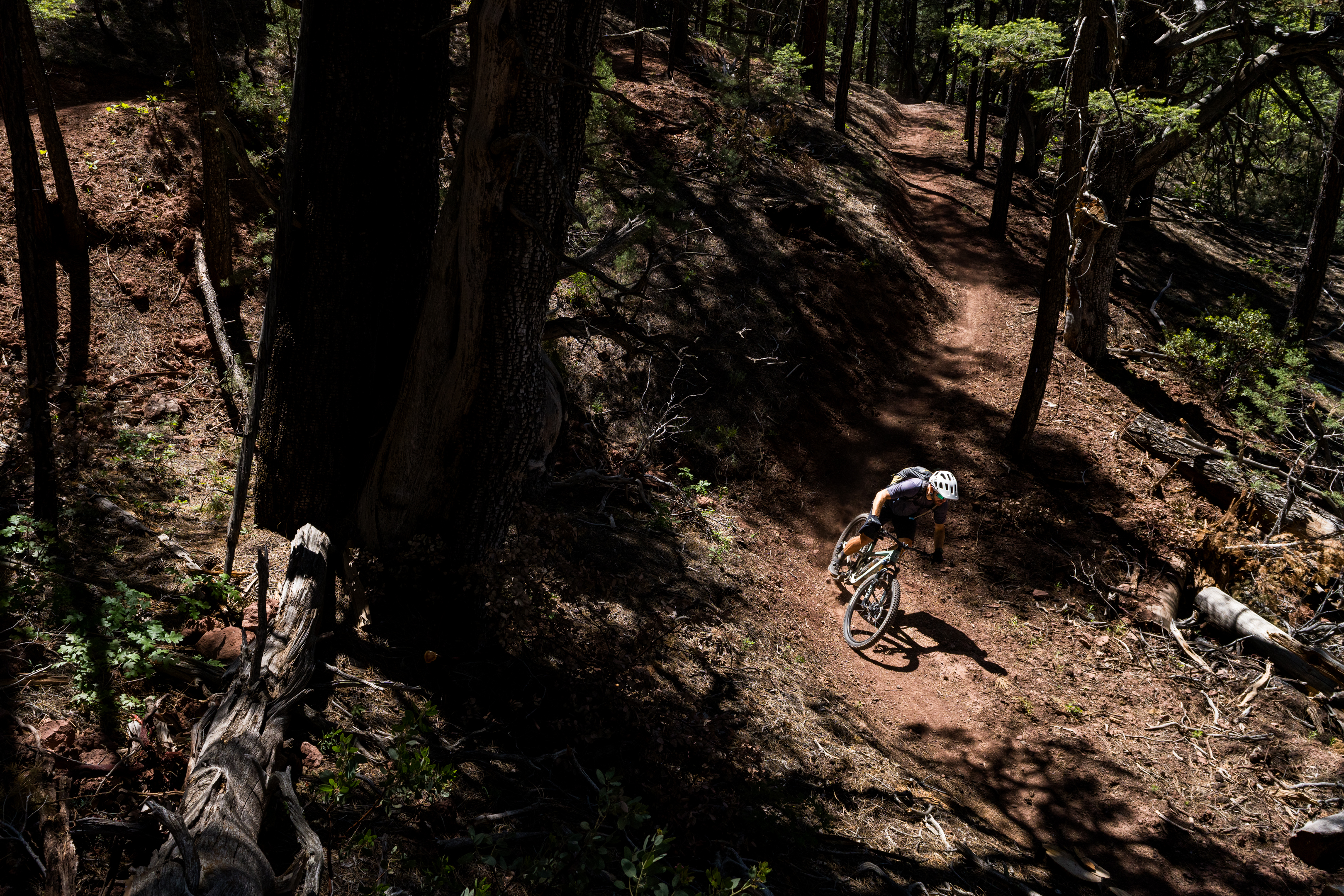
The Inner Sanctum segment begins on fantastic Sedona-style red rock slabs similar to those at the end of day one. But once those slabs conclude, the trail transitions to flowy, machine-built singletrack.
During my many interviews for this article, I heard several people refer to Highline as “purpose-built singletrack,” but I’d take issue with that assessment. Instead, I’d characterize the trail as modern machine-built multi-use trail. Highline is open to hikers and equestrians as well (we saw several horses and mules during our ride), and the tread and corridor are definitely constructed with these users in mind. That said, many sections provide a kinesthetic swoop and flow that mountain bikers will eat up, especially on the Inner Sanctum.
This middle section of the trail is home to the most extensive rerouting on the Highline, consisting almost entirely of brand-new singletrack. As of our ride in 2026, this trail could use a few more tires in places, as it’s starting to get grassy. But now that the entire route is complete, the locals anticipate that traffic will pick up and the trail will get burned in.
 Geronimo’s Call
Highline Day 3: Geronimo’s Call
Geronimo’s Call, the final segment, was the first to be rerouted, and it’s also the section that runs concurrently with the Arizona Trail. Consequently, the singletrack here is the most burned-in of the three sections, making for a fantastic ride.
The third day of riding boasts two of the biggest climbs and descents of the trip. The first nets about 1,000 vertical feet of loss and is immediately followed by an 800-foot climb over the next 6.8 miles, with a 900-foot descent to finish the ride at the Pine trailhead. Keep your eyes peeled for a couple of rocky features on Geronimo’s Call, one of which might exceed the intermediate difficulty rating (but it’s quite short).
Pedaling the Pine-Strawberry Loop
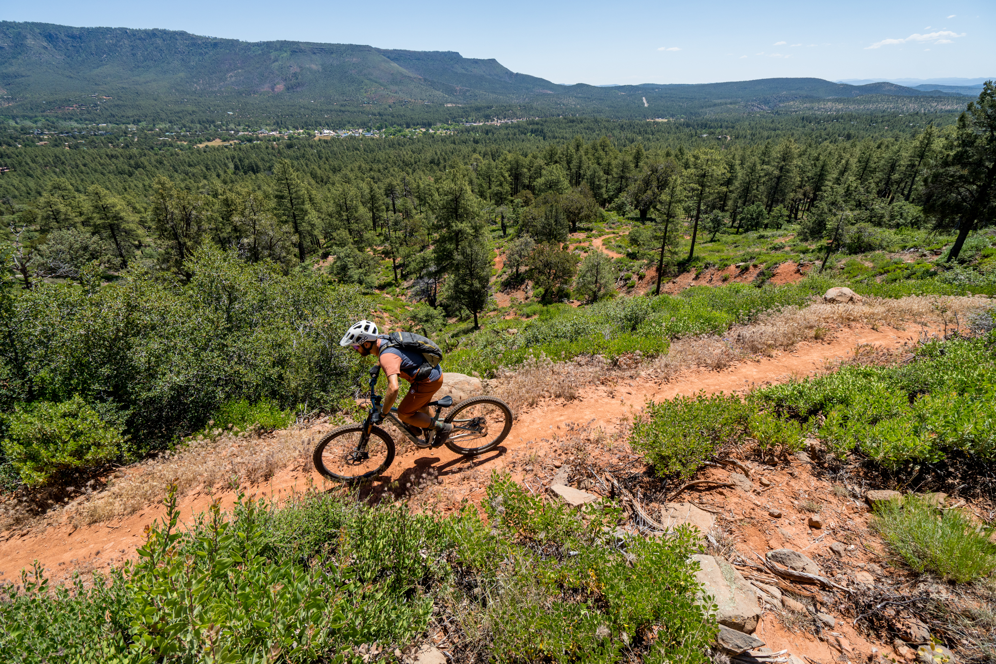
When you preview the Hermosa Tours itinerary, the Pine-Strawberry Loop looks like an add-on after the main course of the Highline Trail. While this loop appears to be close to the town of Pine, it actually provides yet another remarkably wild experience with chunky XC trail followed by flowy downhills. By the time I left camp, rode the loop, and returned to my car at the trailhead, I’d covered almost 23 miles and 2,619 feet of climbing — the most climbing of any ride of the trip.
The loop begins with a grind straight up out of the Pine trailhead, ascending the flanks of the mountain looming over town. This section of trail is older than most of what I’d ridden the previous three days, and as such, it’s also the most technical. Again, no trail features really break into black-diamond territory, but the rocky onslaught requires constant engagement to negotiate. Eventually, you’ll reach a section of newer singletrack that’s a bit flowier.
The loop mostly climbs to the northern end, where it crosses the highway. After the highway crossing, the quality of the trail ratchets up dramatically, with newer-built singletrack carved into the mountainside. Here, overhanging rock cliffs frame the trail, high-quality stonework lines the tread, and after sections of flowy benchcut, you’ll break out of the trees with panoramic views of the valley below.
The final downhill follows Two Ravens, a fresh trail just finished in July 2025. Unfortunately, this is one of the smoothest sections of singletrack and doesn’t offer much of interest for the advanced rider.
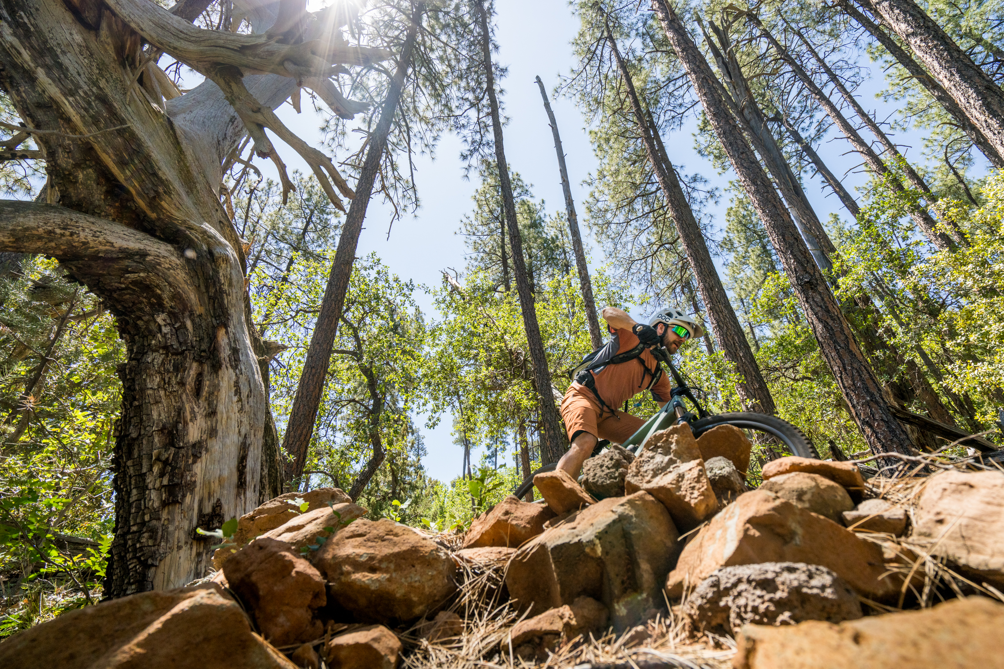
To complete the loop, you have to rejoin the AZT, and it comes as a shock to the system after the butter-smooth singletrack on Two Ravens. A short babyhead-filled downhill on a narrow, overgrown track leads to the gnarliest rock features of the entire trip, within the final two miles back to the trailhead. Don’t worry: everyone will be forced to hike up a few of these sections, and they’re over quickly.
That rocky punch at the end of four days of riding is a timely reminder of just what historic Arizona singletrack is generally like. Over the years, I’ve ridden countless trails just like that one (or even harder), which shows just how much time, money, blood, sweat, and tears have been invested in turning the Highline trail into such a rideable work of art.
Riding over 80 miles of such eminently pedalable singletrack in an otherworldly landscape is almost unheard of. So the next time you’re looking for an epic adventure, skip the Kokopelli and the White Rim, call up Hermosa Tours, and head to the gorgeous singletrack of the Highline Trail instead!
If four days and 89 miles sounds like a bit too much, Hermosa Tours will begin running single-day shuttles on each of the three sections of the Highline Trail in September.


 English (US) ·
  French (CA) ·